THAI SEAS
HomePrachuap Khiri Khan:
Bang Sa Phan Noi district
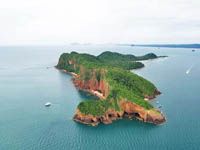
Koh Ta Lu - Koh Singh - Koh Sang:
Courtesy
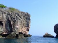
picture of www.thai-tour.com
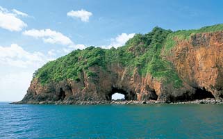
All three
islands, which are located close together, have a shallow snorkelling
site. Koh Ta Lu is the largest among them. At the north end of this
island is a red steep cliff and a big hole that can walk through
another side.
Courtesy
pictures of www.prachuap.org
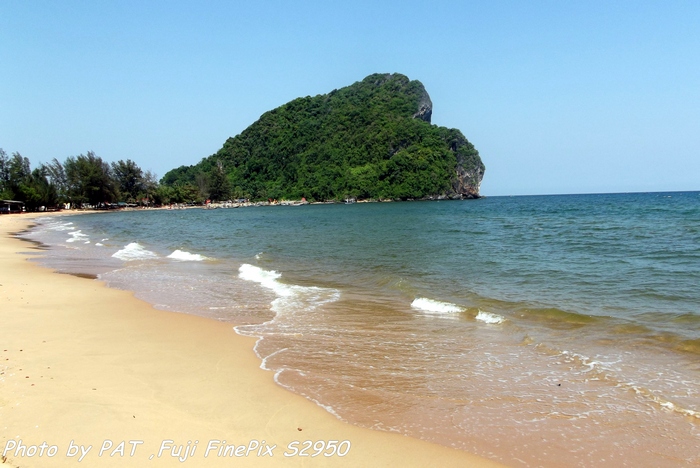
This is its name "Ta Lu" in
Thai Language but English is
"Through". On this island, there are beautiful beaches, clear sea
water, wide white sandy beaches, and many bungalows.
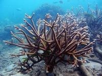
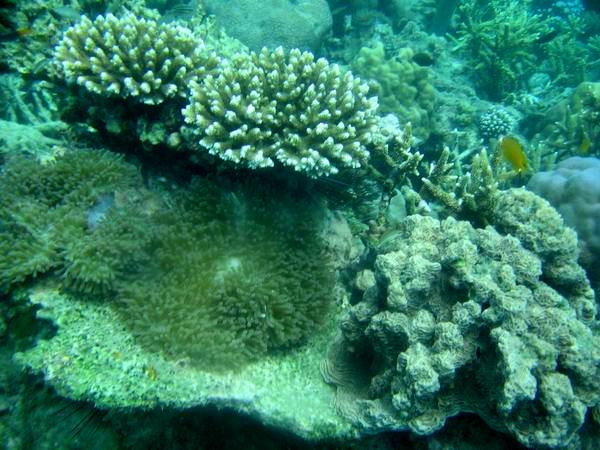
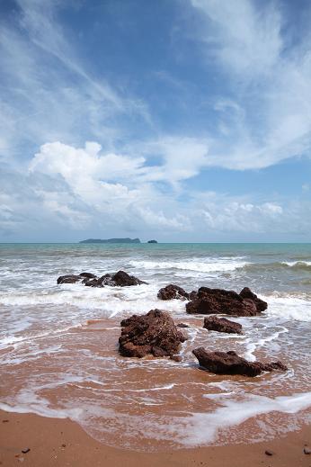
Koh Singh-Koh Sang:
Courtesy
picture of www.thaiscooter.com
They are beautiful spots and
have fertile coral reefs. Sea water is so
crystal clear water which can be easily seen them.
Courtesy
picture of www.prachuap.org
How to get there:
from Bang Sa Bhan Market take the road no.3374 to Koh Ta Lu pier or
continue to Pak Klong Bang Sa Bhan Noi to take the boat to Koh Ta Lu,
Koh Singh and Koh Sang.
Bang Berd Beach:
Courtesy
picture of maejodxer.fix.gs
It is located at Sai Thong sub
district. It is a small curving bay with a clean beach and water. Bang
Berd mountain is located at the end of this beach on southwards. During
World War II, Bang Berd was famous for growing watermelons on the M.C.
Sittibhon Kritsadakorn's plantation. His royal originally brought the
seed from a farm in the USA. The melons were large in size, sweet and
crispy. Today, there is a commemorative monument to his royal in this
area and then now is the Research Institue of Sittibhon Kritsadakorn,
under the supervision of Agro-Ecologocal System Research and
Development Institue of Kasetsart University in Bangkok.
How to get
there: from Bang Sa Bhan Noi take the road no.3411 for
about 15
kilometers. It is the same road to Pa Tiew of Chumpon province. When
you reach junction, turn left for further 4 kilometers to Bang Berd
Beach. Otherwise, take the road no.4 (Petchakasem Road), turn left at
the standing kilometer-stone 425 or Huay Sak junction and continue to
the road no.3497 for about 17 kilometers to Bang Berd Beach.
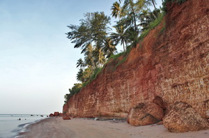
Fang Daeng
Beach:
Courtesy
picture of www.bangburdtour.com
It is not far from
Bang Sa Bhan Noi district downwards to the
south about 9 kilometers. It is a very wonderful beach, lined with a
dark red cliff. The cliff can be seen from the shore that is how it
came to get the name "Fang Daeng Beach". Fang in Thai language is shore
and Daeng is a name of red color in Thai one. When translates Thai
words in Roman alphabets is "Red-colored Shore Beach".
Courtesy
picture of www.bangburdtour.com
More Prachuap Information
- DISTRICTS OF PRACHUAP KHIRI KHAN
- Prachuap Today & History
- Hua Hin district
- Pran Buri district
- Sam Roi Yod district
- Kui Buri district
- Muang Prachuap district
- Thab Sa Kae district
- Bang Saphan district
- Bang Saphan Noi district
- Useful Telephone Numbers
- How to get to Prachuap
- Prachuapkhirikhan Map
- Hua Hin Map
- Hotel-Resort in Hua Hin